
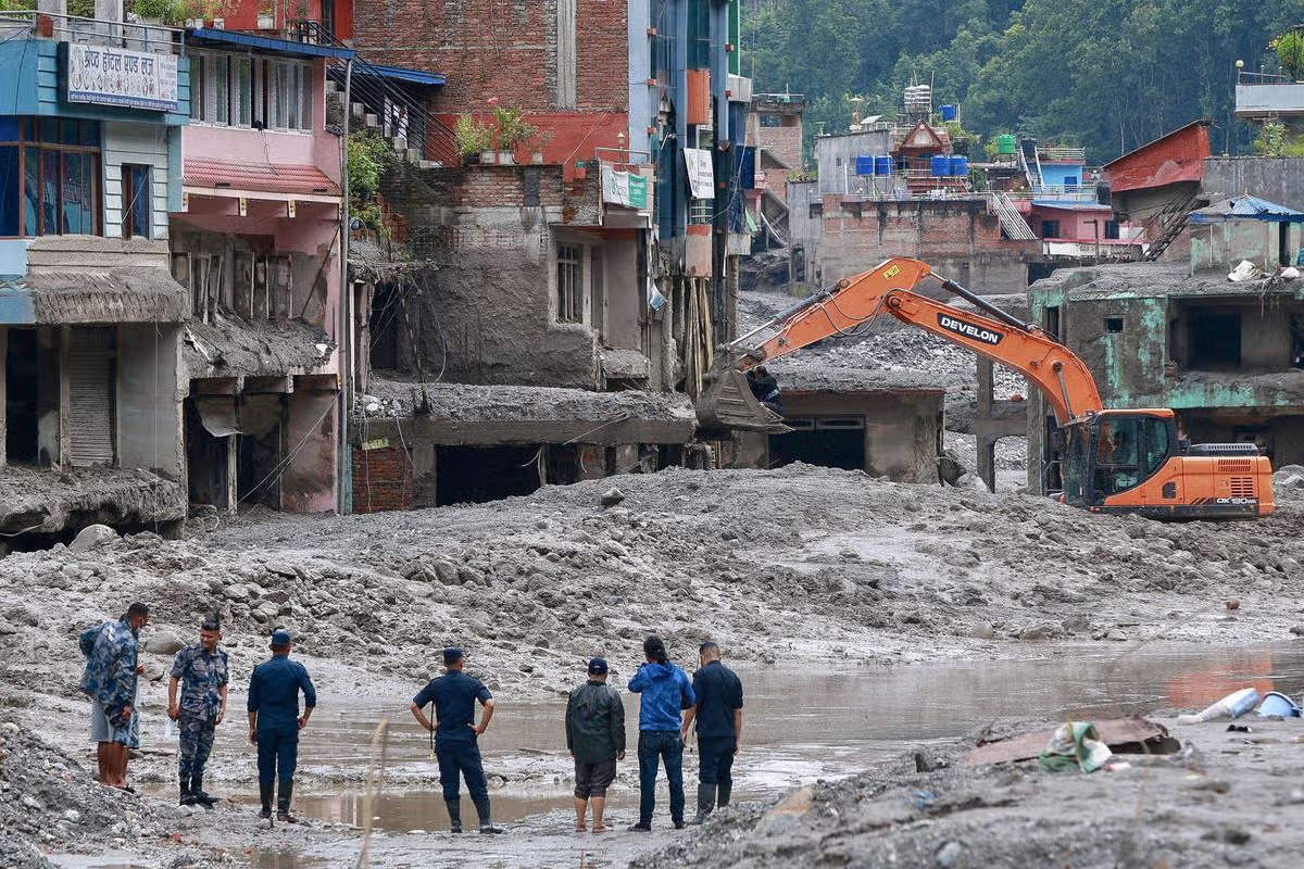

The Nepal flash flood cause has become one of the most searched questions worldwide after a catastrophic wall of ice, mud and water tore through the Nepal-China border region, leaving nearly 3,000 people missing. Scientists say a sudden glacial collapse, possibly combined with a glacial lake outburst, set off the disaster within minutes of a small earthquake.
Background
The flood struck on the morning of August 26 in Nepal’s Rasuwa district, an area along the border with China’s Tibet region. Within moments, a torrent of debris and water surged down from the high Himalayas into the Bhote Koshi river, known as the Lhende river on the Chinese side, before racing downstream and engulfing villages, bridges and hydropower sites.
This is not the first time the region has experienced a glacial flood. Nepal and Tibet’s shared watershed, particularly the area known as the Poiqu basin, has long been flagged by regional scientific bodies as highly prone to glacial lake outburst floods, largely because of the dense concentration of unstable high-altitude glaciers and lakes in the area.
Details: How the Nepal China Flash Flood Happened
According to Nepali officials, the flood began at around 8:40 a.m. local time, just minutes after a magnitude 4.4 earthquake struck on the Chinese side of the border. That tremor appears to have triggered a landslide involving both rock and glacial ice, which then crashed into the Lhende river and caused it to catastrophically overflow its banks.
Nepal’s National Disaster Risk Reduction and Management Authority said a preliminary study, based on satellite imagery analysis, indicated that a debris-laden flood entered the river after a glacial-rock slide occurred roughly 20 kilometres northeast of the Rasuwagadhi border point. Rijan Bhakta Kayastha, a climate researcher at Kathmandu University, suggested that an ice avalanche likely blocked a smaller river first, before the resulting buildup burst and sent a sudden flood surge downstream.
The exact mechanism is still being studied, but the disaster has since created not one but two new lakes formed by debris blocking the river’s natural flow. One of these barrier lakes has become a fresh hazard in its own right, as rising water levels threaten to trigger a second wave of flooding in an area already devastated by the first.
On Friday, that barrier lake broke its banks, temporarily halting rescue work in Rasuwa and prompting Chinese authorities to pause operations at Gyirong Port over fears of a similar event. Officials later said the immediate risk had eased somewhat, after the lake’s water level was observed to fall, allowing rescue teams to resume their search.
Quotes From Scientists and Officials
Rasuwa’s Chief District Officer, Narendra Pariyar, said there had been no rainfall in the district headquarters at the time of the flood, pointing instead to what he described as some kind of natural event higher up in the mountains that may have triggered the disaster. He added that officials could not immediately confirm whether a glacial lake had burst upstream, since the flood appeared without warning.
Climate researcher Rijan Bhakta Kayastha said an initial assessment suggested that an ice avalanche had blocked a river, which then set off the sudden flood surge that devastated communities downstream. His assessment aligns with the region’s known vulnerability to sudden glacial events driven by unstable high-altitude ice formations.
Regional experts from the International Centre for Integrated Mountain Development have previously identified this specific watershed as highly prone to glacial lake outburst floods, a warning that appears to have been borne out by this disaster’s scale and suddenness.
Impact: Why This Type of Flood Is Becoming More Common
Scientists broadly agree that climate change is accelerating glacier melt across the Himalayas, increasing both the frequency and unpredictability of glacial collapses and glacial lake outburst floods. What was once considered a roughly once-in-five-to-ten-years event in the wider Hindu Kush Himalaya region is now occurring with growing frequency as warming temperatures destabilise high-altitude ice and permafrost.
This particular disaster illustrates how a relatively small trigger, in this case a moderate earthquake, can set off a chain reaction in an already unstable glacial environment, resulting in flooding far larger and more destructive than the initial event alone would suggest. The formation of new barrier lakes in the aftermath adds a further layer of risk, since these unstable dams can fail suddenly and with little warning.
For downstream communities in Nepal, India and beyond, the disaster underscores the growing need for early-warning systems capable of detecting glacial instability before it turns catastrophic, particularly in remote, high-altitude areas where monitoring infrastructure remains limited.
Conclusion
While the precise sequence of events behind the Nepal China flash flood is still being investigated, the combination of a triggering earthquake, an unstable glacier and the region’s known vulnerability to glacial lake outburst floods paints a fairly clear picture of the disaster’s origins. As scientists continue studying the site and the newly formed barrier lakes, further findings are expected to refine the understanding of exactly what happened and how similar disasters might be predicted in the future.
Authorities in both Nepal and China are likely to face growing pressure to invest in better glacial monitoring and early-warning systems in the aftermath of this disaster, given the scale of loss and the region’s history of recurring glacial flood risk.
Frequently Asked Questions
How did Nepal’s flood happen?
The flood was triggered by a glacial collapse in the high Himalayas near the Nepal-China border, occurring just minutes after a magnitude 4.4 earthquake struck on the Chinese side. The resulting landslide of rock and ice entered the Lhende river, known as the Bhote Koshi in Nepal, causing it to overflow catastrophically and send a debris-laden flood surge downstream into Rasuwa district, destroying villages, bridges and hydropower infrastructure along the way.
What happened at the Nepal-China border?
Both sides of the border were devastated simultaneously, with Nepal’s Rasuwa district and China’s Gyirong County in Tibet bearing the brunt of the disaster. The Miteri Bridge linking the two countries was swept away, and the flood buried infrastructure on both sides under thick layers of mud. A newly formed barrier lake created by flood debris later added a secondary threat, briefly halting rescue operations after it began to overflow its banks.
How many have died in Nepal?
Nepal’s disaster-management authority has reported hundreds of confirmed deaths, with the toll continuing to climb as search teams clear mud and debris from the disaster zone. Combined with people still unaccounted for, the number of missing across Nepal and the Chinese side of the border has approached nearly 3,000, and officials have warned that both the confirmed death toll and the scale of destruction are likely to increase as recovery operations continue.