
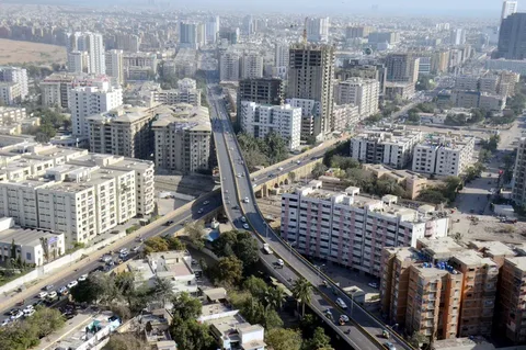
Walk through almost any part of Karachi and you’ll find neighborhoods that weren’t on anyone’s master plan when the city was originally designed. They grew because people needed somewhere to live, and the formal housing system simply couldn’t keep pace with how fast Karachi was expanding. These are the Katchi Abadis Pakistan’s largest city’s sprawling network of informal settlements that now house a significant portion of its population.
Understanding the Karachi Katchi Abadi list isn’t just an academic exercise in urban planning. It’s understanding how millions of people actually live, how the city has grown over decades, and what challenges Karachi faces as it continues to expand.
What Exactly Is a Katchi Abadi?
In the simplest terms, a Katchi Abadi is a residential settlement that began informally without the official approvals, zoning permissions, or planning processes that govern formal housing developments.
These communities typically start the same way. Families looking for affordable housing close to where they work settle on available land, often vacant government plots or areas near industrial zones. What starts as a cluster of basic shelters gradually evolves. Roads get improved. Electricity connections arrive. Schools open. Residents who initially built temporary structures invest in permanent homes as their security in the area increases.
Some of these settlements eventually receive formal legal recognition through government regularization processes. Others remain in a more uncertain legal status, sometimes for decades, caught in disputes over land ownership or unresolved documentation.
How Karachi Got Here: A Quick History
The story of Karachi’s informal settlements goes back generations. Population migration into the city accelerated significantly after independence, as Karachi became Pakistan’s primary commercial and industrial center almost overnight.
As factories and industries expanded, workers needed housing close to their jobs. The formal housing sector — developers, government housing schemes, planned residential projects — simply couldn’t build fast enough to absorb the numbers of people arriving. So communities formed organically, near industrial zones, transport corridors, and available land.
The pace accelerated through the 1970s, 80s, and 90s as Karachi’s population growth outpaced almost every other major city in South Asia. Successive governments eventually introduced regularization policies, recognizing that these settlements weren’t going away and that improving them was more practical than trying to eliminate them.
Where These Settlements Exist Across Karachi
The Karachi Katchi Abadi list spans the entire city — hundreds of settlements distributed across every district, each with its own history, population, and level of development.
You’ll find significant concentrations in Central Karachi, East Karachi, West Karachi, Korangi, Keamari, Malir, and South Karachi. Within each of these districts, multiple settlements exist side by side, some decades old and fully integrated into the urban fabric with schools, markets, and paved roads, others still working through the basics of infrastructure and legal status.
What’s notable is the range. Some Katchi Abadis today are virtually indistinguishable from any other established Karachi neighborhood functioning markets, public transportation access, healthcare facilities. Others continue to struggle with fundamental issues like clean water access and drainage.
Reading the Map: Why Location Matters
The Katchi Abadis Karachi map tells a story about how the city actually grew, as opposed to how it was originally planned to grow.
Most settlements cluster near specific features industrial zones where residents found employment, major transport corridors and railway lines that made commuting feasible, the port area, commercial markets, and government land that wasn’t being actively used. This pattern makes sense: people settled where the economic opportunity was, regardless of whether the land had been formally designated for residential use.
Urban planners rely on these maps for genuinely practical purposes identifying where infrastructure investment is needed most, where new schools or clinics should be built, where drainage systems need upgrading, and how transportation networks should expand to serve these communities. Modern satellite imagery and geographic information systems have made this kind of planning significantly more precise than it used to be, allowing authorities to track settlement growth in close to real time.
Why These Communities Kept Growing
Several forces converged to drive the expansion of Katchi Abadis across Karachi, and they’re worth understanding individually.
Population growth is the most obvious factor. Karachi has been among the fastest-growing cities in South Asia for decades, with continuous migration from across Pakistan adding pressure to an already strained housing market.
Housing shortages compounded the problem. Formal housing supply never matched the pace of population growth, and rising property prices put legal homeownership increasingly out of reach for low-income families trying to establish themselves in the city.
Proximity to employment drove specific settlement patterns. Workers in industrial zones, ports, and commercial districts often chose to live as close as possible to their jobs, minimizing transportation costs and commuting time in a city where both can be significant burdens.
Rural migration added a steady stream of new arrivals people leaving agricultural areas for the employment, healthcare, and educational opportunities that Karachi, despite its challenges, still offers in greater abundance than much of rural Pakistan.
The Legal Patchwork: Who Owns What
Not every Katchi Abadi has the same legal standing, and this variation matters enormously for residents’ security and access to services.
Some settlements have achieved full regularization government recognition that allows residents to obtain legal ownership documents through official processes. This status provides genuine security and typically comes alongside infrastructure investment from local authorities.
Others are in a kind of legal middle ground eligible for regularization in principle, but still working through documentation requirements or infrastructure standards that need to be met before formal recognition is granted.
A third category remains non-regularized, often due to genuine legal disputes over land ownership, environmental concerns about the location, or other complications that haven’t been resolved. Residents in these settlements face more uncertainty, which affects everything from their willingness to invest in permanent housing to their access to municipal services.
The Infrastructure Reality
Progress in Katchi Abadis has been real but uneven, and several persistent challenges remain across many settlements.
Water access varies considerably some areas have proper municipal connections, while others still depend on water tankers, an arrangement that’s both more expensive and less reliable for residents. Drainage remains a serious concern in many settlements, with poor systems creating significant flooding risk whenever heavy monsoon rains hit the city.
Road quality differs dramatically from settlement to settlement. Some have been paved and properly maintained for years; others are still unpaved tracks that become difficult to navigate during rain. Healthcare access has generally improved as clinics have been established in many areas, though growing populations continue to strain available medical capacity. Education has seen similar improvement government and private schools now operate in many Katchi Abadis but the quality and availability of educational resources remains inconsistent across the city.
The Economic Engine Nobody Talks About Enough
Despite the infrastructure challenges, it’s worth being clear about something: Katchi Abadis are not a drain on Karachi’s economy. They’re a significant part of what makes it function.
Residents work across manufacturing, construction, transport, retail, domestic services, and informal trade — sectors that Karachi’s broader economy genuinely depends on. Many of these communities have developed thriving local markets and small businesses that serve not just their own residents but surrounding neighborhoods as well.
The labor that keeps Karachi’s factories, construction sites, and service industries running disproportionately comes from these communities. Any honest accounting of Karachi’s economic engine has to recognize that contribution rather than treating Katchi Abadis as simply a housing problem to be solved.
What’s Being Done And What Still Needs to Happen
Government institutions and urban planning authorities have introduced various initiatives over the years aimed at improving conditions in these settlements infrastructure upgrades, road construction, sewerage improvements, expanded water supply, housing regularization programs, and better land record documentation.
Progress has been real in many areas, but uneven across the city. The bigger question going forward is what sustainable, long-term planning looks like for a city that continues to grow rapidly.
Experts generally point to a few priorities: significantly more affordable housing development to reduce the pressure that drives informal settlement growth in the first place, better public transportation networks that allow more balanced urban expansion rather than concentration around a few employment centers, more accurate and accessible digital mapping to help authorities plan proactively rather than reactively, and serious environmental planning to protect waterways, green spaces, and ecologically sensitive areas from unplanned development.
Why Accurate Mapping Matters More Than People Realize
The Katchi Abadis Karachi map isn’t just a reference document it’s become a genuinely essential planning tool as satellite imagery and geographic information systems have advanced.
Updated mapping allows authorities to monitor how settlements are growing in close to real time, plan infrastructure projects where they’re actually needed, improve emergency service response in these communities, allocate development funding more effectively, keep land records current, and support disaster management planning — which matters enormously given Karachi’s exposure to monsoon flooding.
Better data, in this case, translates directly into better outcomes for residents who have historically been underserved by city planning processes that didn’t account for how the city was actually growing.
Looking Ahead
Karachi’s population isn’t going to stop growing, and that reality shapes every conversation about its future. The pressure on housing, transportation, healthcare, education, and public utilities will continue regardless of what policies are adopted.
The central tension balancing affordable housing needs with environmental protection and sustainable development is one that planners, government agencies, and the communities themselves will need to navigate together. There’s no version of Karachi’s future that doesn’t involve serious, sustained investment in the infrastructure and legal recognition that many Katchi Abadis still lack.
The Bottom Line
The Karachi Katchi Abadi list represents decades of migration, economic necessity, and organic urban growth that happened faster than formal planning could accommodate. Many of these settlements have transformed into fully functioning neighborhoods. Others remain works in progress, both legally and physically.
The Katchi Abadis Karachi map will remain an essential tool for understanding how the city is actually distributed and where development priorities need to focus. As Karachi continues growing and it will sustainable planning, affordable housing, and improved public services for these communities aren’t optional extras. They’re central to what kind of city Karachi becomes.
FAQs
Is Karachi a wealthy city?
Karachi is genuinely Pakistan’s financial and commercial capital, generating a substantial share of the national economy through banking, trade, manufacturing, shipping, and services. But that wealth is distributed very unevenly. Alongside affluent business districts and upscale residential areas, the city has significant income inequality, with many communities including large parts of the Katchi Abadi population facing real challenges around housing security, infrastructure access, and basic public services. Calling Karachi simply “wealthy” misses this fundamental divide that shapes daily life for millions of residents.
What does Karachi’s geography actually look like?
Karachi sits along the Arabian Sea coast in southern Pakistan, which gives it enormous strategic importance as the country’s largest seaport and a critical gateway for international trade. The geography itself is varied coastal plains, sandy beaches, rocky hills inland, mangrove forests along parts of the coastline, and a constantly expanding urban footprint that has absorbed surrounding areas over decades. The combination of warm climate, extensive coastline, and strategic port access has made Karachi one of South Asia’s most economically significant cities, even as that same growth has created the housing pressures that produced its Katchi Abadis.
Can you give a short overview of what Karachi is like?
Karachi is Pakistan’s largest city and serves as its economic, financial, and maritime center, home to millions of people from remarkably diverse linguistic, ethnic, and cultural backgrounds. It’s a city of contrasts — historic landmarks and modern commercial districts, major universities and informal settlements, bustling ports and quiet residential neighborhoods. Karachi continues evolving rapidly, with new developments and urban planning initiatives constantly reshaping the city, even as it works to address the ongoing challenges of population growth and ensuring adequate, affordable housing for everyone who calls it home.